Cordillère Centrale
The roof of the Caribbean: pine forests, Pico Duarte at 3,098 meters, Constanza's vegetable plateaus and waterfalls of the Yaque del Norte, three hours from Santo Domingo.
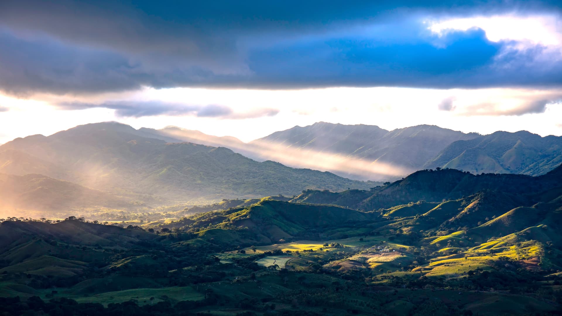
The Cordillère Centrale forms the backbone of the island of Hispaniola. From our agency in Santo Domingo, we spend roughly three hours reaching Jarabacoa via the Duarte highway and the winding road that climbs from Bonao. As altitude gains, the landscape transforms: sugarcane fields give way to coffee plantations, then to pine groves of Pinus occidentalis, an endemic species that grows above 1,000 meters. The climate shifts too. At Constanza, perched in a basin at 1,200 meters, January nights drop to 5 or 10°C, and frost sometimes settles on the heights near Valle Nuevo.
This region concentrates the Caribbean's highest peaks. Pico Duarte rises to 3,098 meters, followed by La Pelona and La Rucilla, all clustered within the José Armando Bermúdez national park. Climbing Duarte typically takes three days from the village of La Ciénaga, near Manabao, with an overnight at the La Compartición refuge. It's a test of endurance more than technical difficulty, though the ascent often begins at night to reach the summit at sunrise. We organize this with local muleteers who carry provisions and gear.
Jarabacoa, at 530 meters elevation, serves as the base camp for most activities. The town is crossed by the Yaque del Norte river, the country's longest river, where rafting is practiced over roughly twelve kilometers of Class II and III rapids. The region's waterfalls can be visited on day trips: the Salto de Jimenoa Uno with its 60-meter drop in a narrow gorge, the more accessible Salto Baiguate, and a bit further the Aguas Blancas near Constanza, which plunges 83 meters in several tiers at 1,680 meters elevation.
Constanza and its agricultural plateau produce most of the country's strawberries, cabbage, potatoes and cut flowers. It's a patchwork landscape that surprises travelers accustomed to the tropical vegetation of the coast. Part of the population descends from Japanese colonists settled here in the 1950s under the Trujillo government, and some farms still bear their names. Around Jarabacoa, Caturra and Typica coffee farms can be visited at Manabao and Los Dajaos, with tastings at the producer's site. Mountain cuisine differs from that of the coast: slowly simmered sancocho, chivo guisado (goat stew), grilled longanizas and habichuelas con dulce during Lent.
Culturally, the region remains deeply rural and Catholic, with patron saint festivals like that of San Antonio in Jarabacoa in June. Secondary roads between Constanza, San José de Ocoa and Padre las Casas wind through hamlets where life moves to the rhythm of harvests. This is not a region of monuments; it's a region of respite: you come here to walk, to cool down in temperature, to understand that the Dominican Republic is more than its beaches.
We send travelers here who are building itineraries of two weeks or longer and who want to break from the beach rhythm. Three to four days suffice for a first contact, longer if you add the Pico Duarte trek.
To discover
Pico Duarte climb. Three-day trek from La Ciénaga with mules and muleteer, overnight at a refuge at 2,450 meters and arrival at the summit at 3,098 meters at daybreak, weather permitting.
Rafting on the Yaque del Norte. Twelve kilometers of descent in Class II and III rapids departing from Jarabacoa, through a canyon lined with giant bamboos and kapok trees.
Constanza vegetable plateau. Highland valley at 1,200 meters where strawberries, cabbage and cut flowers grow, with its Japanese farms inherited from the 1950s migration.
Aguas Blancas waterfall. An 83-meter drop in three tiers, accessible by 4x4 track from Constanza, within the Valle Nuevo scientific reserve at 1,680 meters elevation.
Manabao coffee farms. Visit a family plantation above Jarabacoa, patio drying and artisanal roasting, around a cup of Caturra grown at 1,100 meters.
When to visit
The best period runs from December through March: clear skies during the day, temperatures of 18 to 24°C in Jarabacoa, cool nights of 8 to 12°C in Constanza. For climbing Pico Duarte, we recommend this same window, avoiding September through November when rains turn trails muddy and summit visibility is often nil. Rafting, meanwhile, is more rewarding between May and October, when the Yaque del Norte flow is more robust.
April and May mark a pleasant transition with spectacular blooms in the Constanza valley. Avoid the active hurricane season from August to October, not so much for hurricanes that mainly strike the coasts as for mountain roads that can be cut by landslides. In summer, count on 25 to 28°C during the day in Jarabacoa, which remains more bearable than the ambient 33°C on the coast.
Practical advice
We recommend a minimum of three days for the Cordillère Centrale, based in Jarabacoa, with an excursion to Constanza and a half-day of rafting or waterfall visiting. Budget five days if you add the Pico Duarte trek, which requires three full days plus a recovery day. Access is by road from Santo Domingo (3.5 hours to Jarabacoa) or from Santiago airport (1.25 hours), making it an easy stop to fit after arriving in the north.
The region pairs well with the North Coast and Puerto Plata for a mountain-and-sea itinerary, or with the Samaná Peninsula via Santiago and San Francisco de Macorís. Lodging remains rustic yet well-maintained: wooden lodges around Jarabacoa, small family hotels in Constanza. No international chains, no all-inclusives. This is a region we offer to hikers, families with walking-age children, contemplative travelers and those wanting to grasp the country's geographic diversity beyond the beach cliché.